سجل الدخول باستخدام غوغل
 تسجيل الدخول باستخدام فاسيبوك
Jerusalem (Jordan) and region planning proposals [cartographic material] / Drawn by Khalid Assaly. Prepared in the office of the town planning adviser H. Kendall.
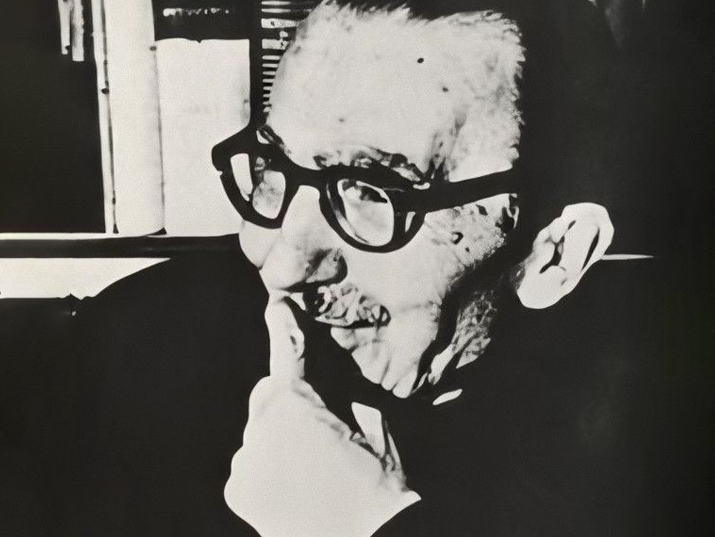
Henry Kendall 1903-1983
خريطةمرحبا بك! يمكنك التسجيل عن طريق ملء التفاصيل الشخصية الخاصة بك أو عن طريق الدخول إلى حسابك في الفيسبوك أو غوغل
او
| العنوان |
Modern Jerusalem and the surrounding country from Bethlehem to Bethel Chiefly from the survey of Dr. Barclay. |
|---|---|
| الناشر |
[London] : [Society for Promoting Christian Knowledge] |
| تاريخ الإصدار |
[1868] |
| ملاحظات |
Digital image of the original in Amir Cahanovitc Collection, Israel. ACC 1614-8. Digital image received from donor. From: The bible atlas of maps and plans to illustrate the geography and topography of the old and new testaments and the Apocrypha, with explanatory notes, By Samuel Clark, M. A., Vicar of Bredwardine, Hereford. Also a complete index of the geographical names in the English Bible, by George Grove. Inset: No. 22. The division of the Holy Land after A. D. 52. אוסף אמיר כהנוביץ Original map: 25.1 x 19.1 cm. |
| الشكل |
1 online resource (1 map). |
| اللغة |
الانكليزية |
| الإعتمادات |
אמיר כהנוביץ |
| رقم النظام |
990039088150205171 |
عند كل استخدام، يجب تحديد المادة في النموذج التالي:
אמיר כהנוביץ
תנאי השימוש:
يُسمح بنسخ المادة لأي غرض واستخدامها لأي غرض.
لا حاجة للتوجّه إلى المكتبة الوطنية للحصول على إذن باستخدام المادة.
معلومات إضافية:
تخضع هذه المادة للملكيّة العامّة (Public Domain) ولا تسري عليها حقوق التأليف والنشر المتّبعة في دولة إسرائيل.
وجب الانتباه إلى أنّ قواعد حقوق التأليف والنشر قد تختلف من دولة إلى أخرى ولذلك، إذا كنت ترغب/ترغبين في استخدام المادة خارج دولة إسرائيل، عليك التحقق من قواعد حقوق التأليف والنشر حسب القانون الساري في الدولة المعنية.
إذا كنت تعتقد/ين أنّه قد وقع خطأ في المعطيات الواردة أعلاهُ، أو أنّك تعتقد/ين أنّ هناك انتهاكًا لحقوق التأليف والنشر بشأن هذه المادة، فيرجى التوجُّه إلينا من خلال الاستمارة التالية
أتعرفون المزيد عن هذا العنصر؟ وجدتم خطأ ما؟