Loma Prieta Earthquake, Calif., 1989
Enlarge text Shrink text-
 Topic
Topic

-
Save successfulThe item can be found in your Personal ZoneשגיאהLog in to your account to save

- GeoRef Thes.(Loma Prieta earthquake, 1989; Santa Cruz Co. W. Calif.)
- USGS Earthquake Hazards Program/Large Earthquakes in the United States web site, Apr. 1, 2003(Santa Cruz Mountains (Loma Prieta), California 1989 10 18: In the Santa Cruz Mountains in the forest of Nisene Marks State Park, about 16 km. northeast of Santa Cruz and about 7 km. south of Loma Prieta Mountains, Calif. It was the largest earthquake to occur on the San Andreas fault since the great San Francisco earthquake in April 1906)

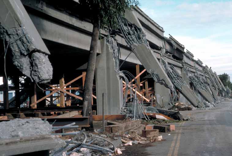
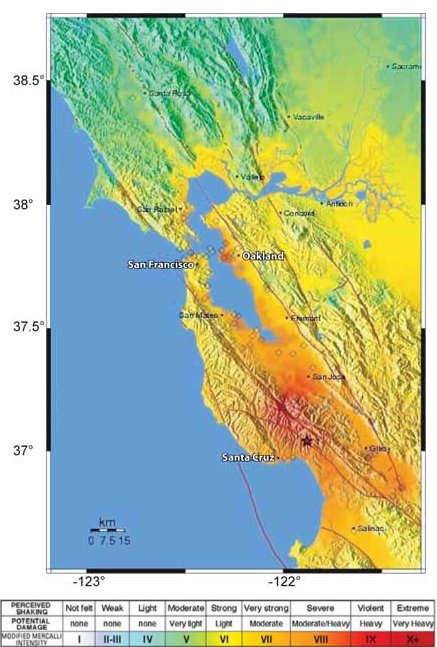
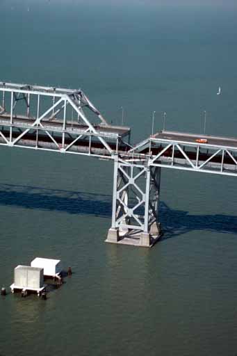
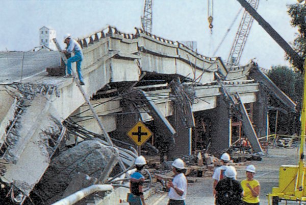
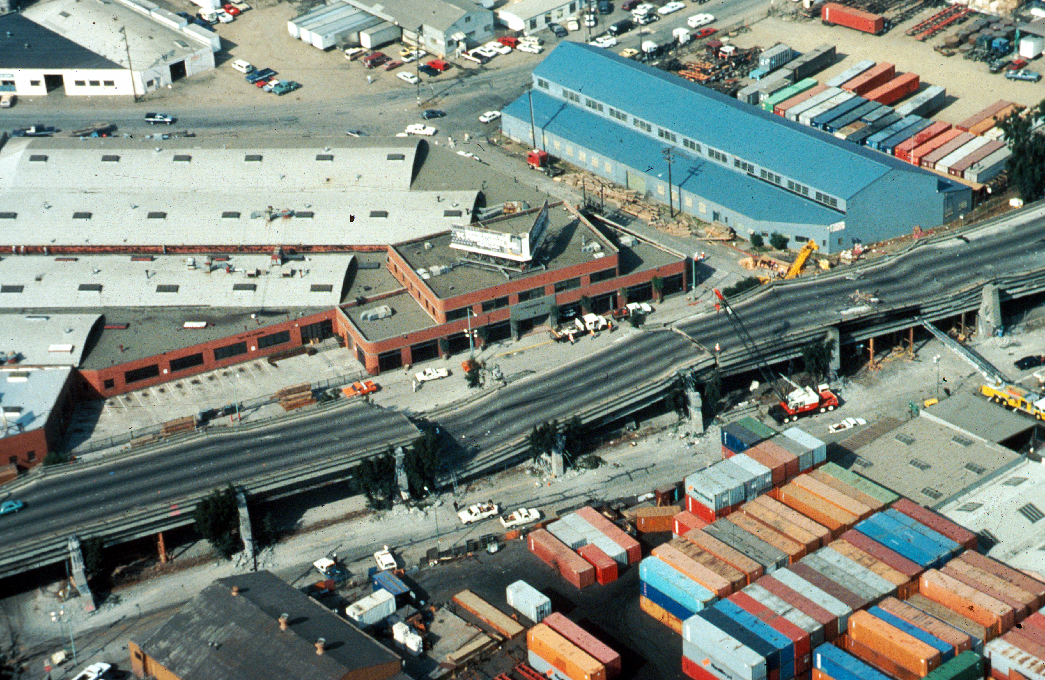


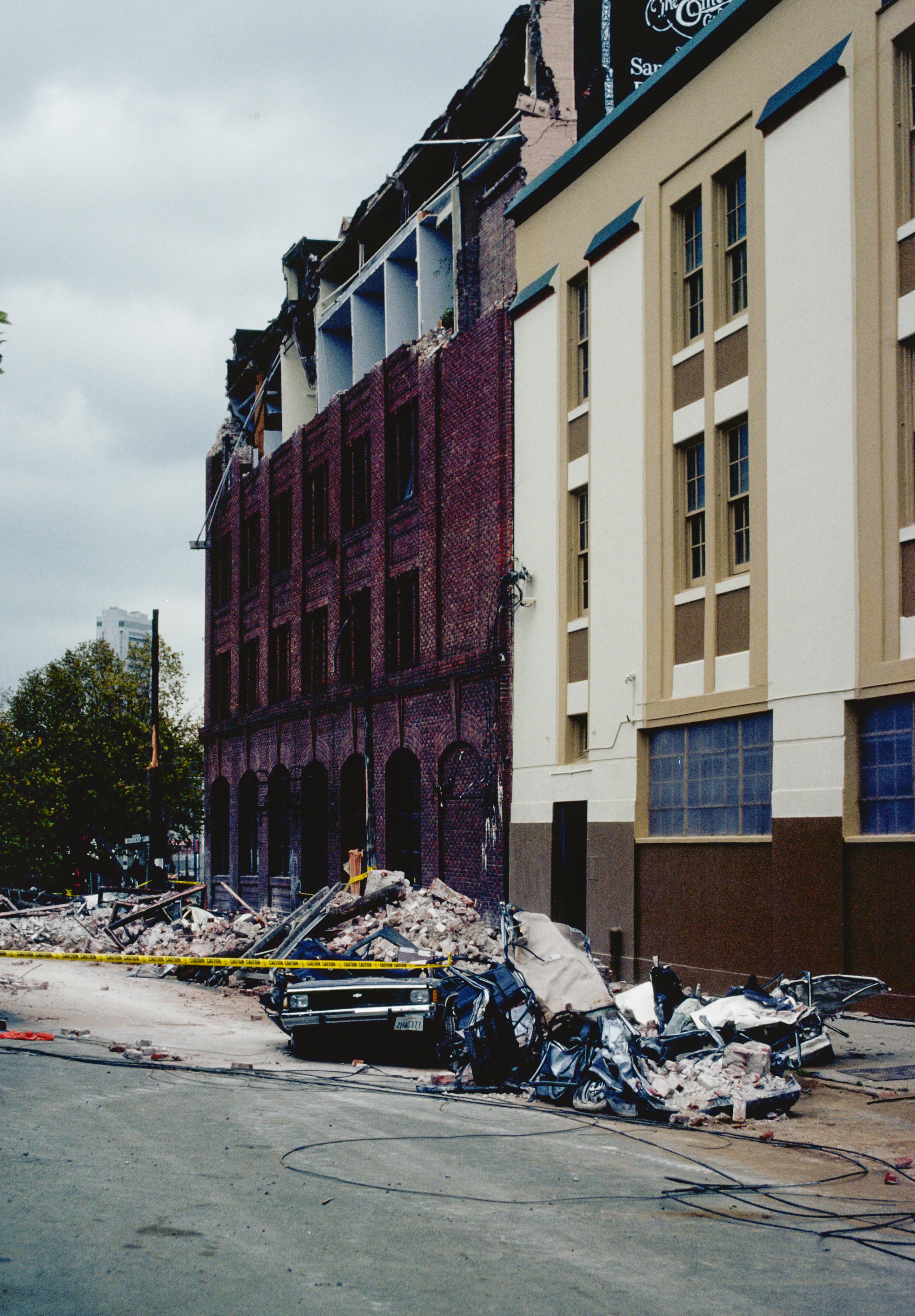

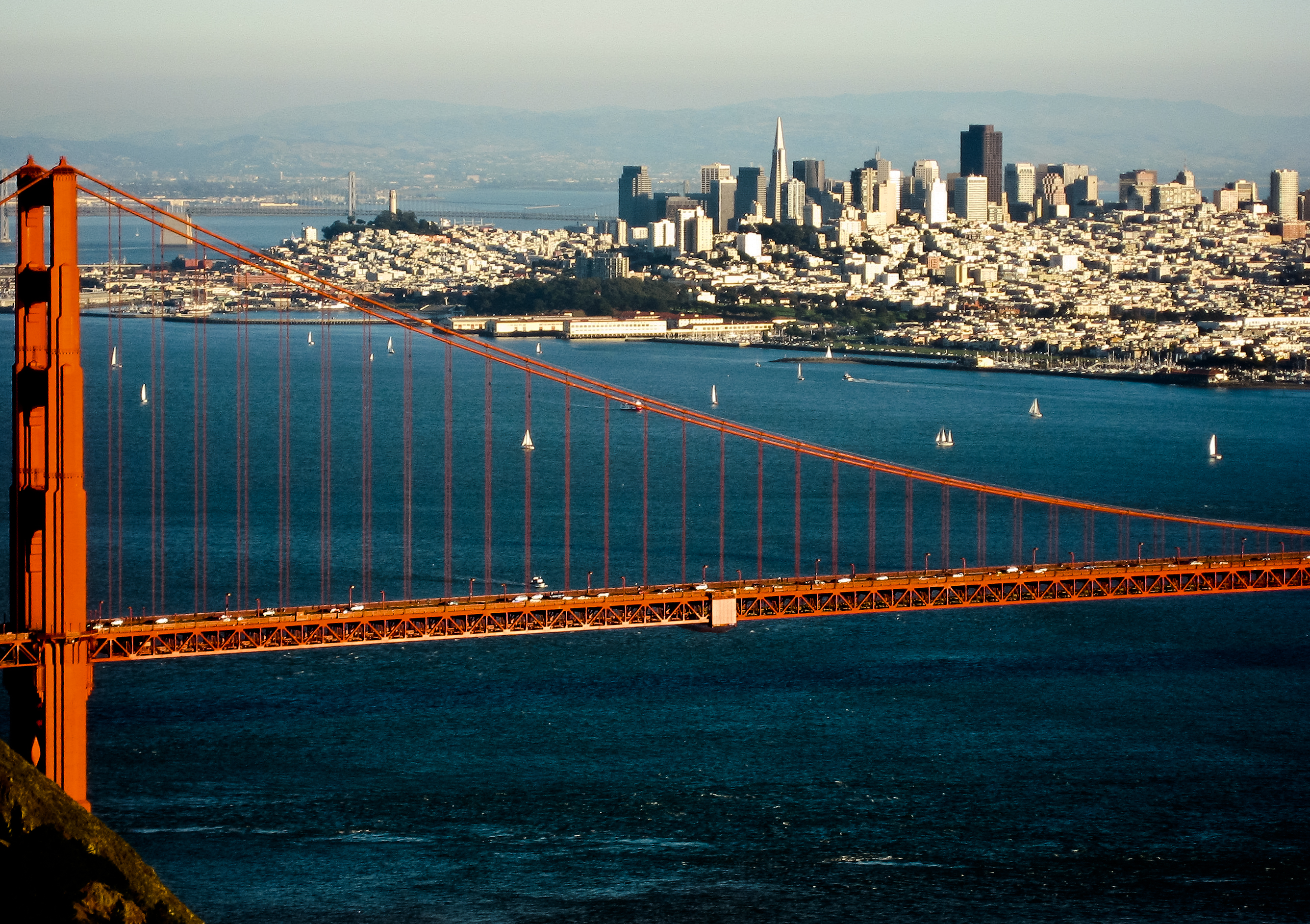


On October 17, 1989, at 5:04 p.m. PST, the Loma Prieta earthquake occurred at the Central Coast of California. The shock was centered in The Forest of Nisene Marks State Park in Santa Cruz County, approximately 10 mi (16 km) northeast of Santa Cruz on a section of the San Andreas Fault System and was named for the nearby Loma Prieta Peak in the Santa Cruz Mountains. With an Mw magnitude of 6.9 and a maximum Modified Mercalli intensity of IX (Violent), the shock was responsible for 63 deaths and 3,757 injuries. The Loma Prieta segment of the San Andreas Fault System had been relatively inactive since the 1906 San Francisco earthquake (to the degree that it was designated a seismic gap) until two moderate foreshocks occurred in June 1988 and again in August 1989. Damage was heavy in Santa Cruz County and less so to the south in Monterey County, but effects extended well to the north into the San Francisco Bay Area, both on the San Francisco Peninsula and across the bay in Oakland. No surface faulting occurred, though many other ground failures and landslides were present, especially in the Summit area of the Santa Cruz Mountains. Liquefaction was also a significant issue, especially in the heavily damaged Marina District of San Francisco, but its effects were also seen in the East Bay, and near the shore of Monterey Bay, where a non-destructive tsunami was also observed. Because it happened during a national live broadcast of the 1989 World Series, the annual championship series of Major League Baseball, taking place between Bay Area teams San Francisco Giants and the Oakland Athletics, it is sometimes referred to as the "World Series earthquake", with the championship games of the year being referred to as the "Earthquake Series". Rush-hour traffic on the Bay Area freeways was much lighter than normal because the game, being played at Candlestick Park in San Francisco, was about to begin, and this may have prevented a larger loss of life, as several of the Bay Area's major transportation structures suffered catastrophic failures. The collapse of a section of the double-deck Nimitz Freeway in Oakland was the site of the largest number of casualties for the event, but the collapse of human-made structures and other related accidents contributed to casualties occurring in San Francisco, Los Gatos, and Santa Cruz.
Read more on Wikipedia >