Sign in with Google
 Sign in with Facebook
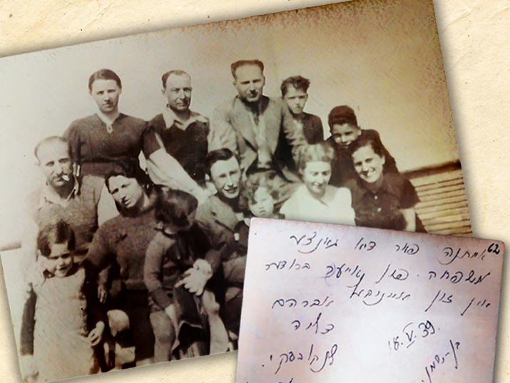
From Ben Shemen to the Concentration Camp and Back: The Story of a Family Photo
Family. Young men and women who share DNA or marital ties, and three little children, all of them smiling for a photographer, frozen in one moment in time and in a single place: Kovno, 1939. Just a few months before the whole world turned upside down. Ostensibly, this is a perfectly ordinary family
To the article on our blog